| dd.mm.000 | |||||
|---|---|---|---|---|---|
| Symbol | Description | Comment | Type | Latitude | Longitude |
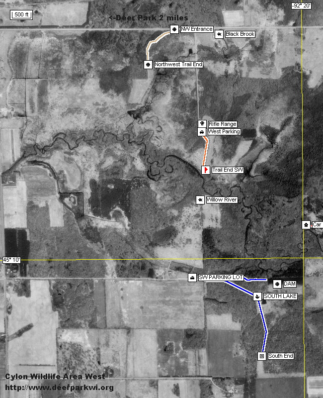
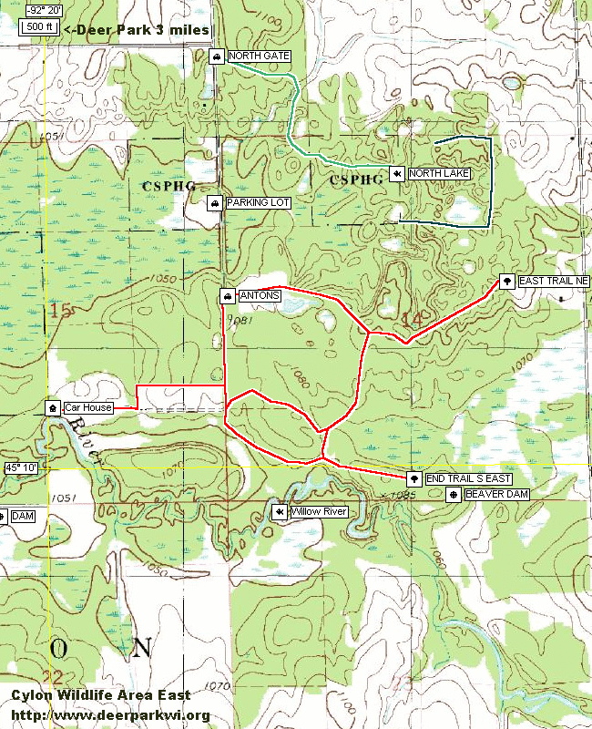
| Boat | DNR built lake dam. | Dam | Landmark | 45°09.891' | -92°20.198' |
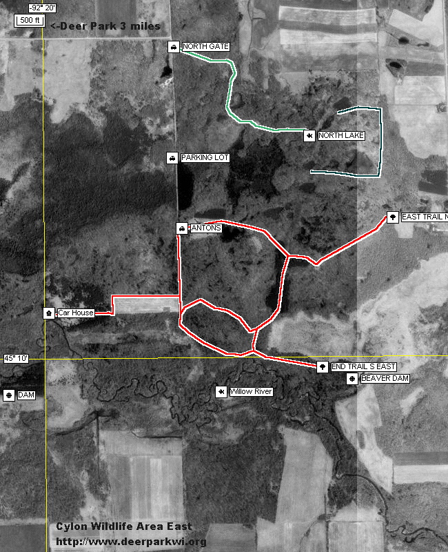
| Boat | Beaver Dam | Beaver Dam | Landmark | 45°09.928' | -92°18.636' |
| Boat | South Lake DNR Created Lake |
South Lake | Landmark | 45°09.833' | -92°20.283' |
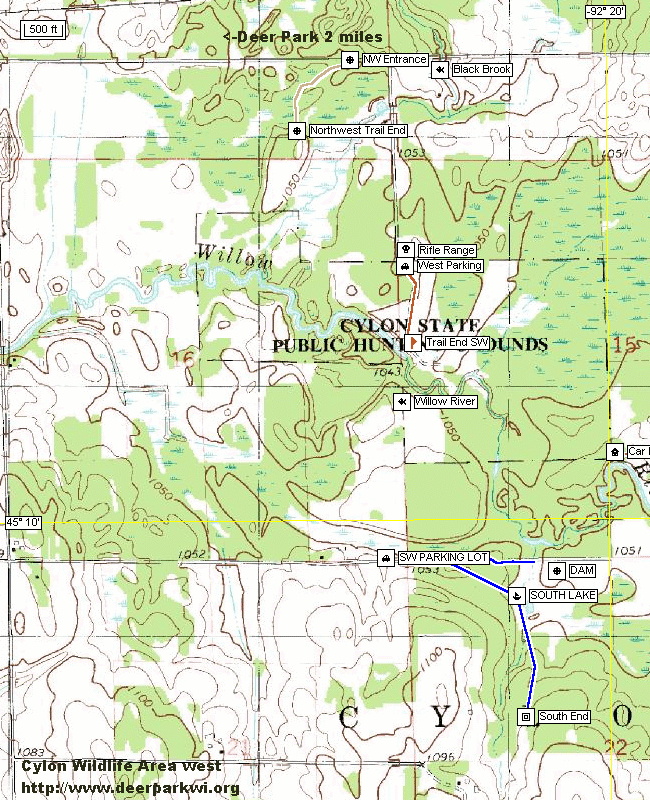
| Car | 240th Street Parking Lot |
North Parking | Parking | 45°10.624' | -92°19.430' |
| Car | 210th Street Parking Lot |
SW Trailhead Blue Trail Parking |
Parking | 45°09.917' | -92°20.683' |
| Car | 230th Street Parking Lot | Orange Trailhead Rifle Range |
Parking | 45°10.550' | -92°20.617' |
| Car | Red Trail Parking | Antons Red Trailhead | Parking | 45°10.417' | -92°19.400' |
| Red Trail NE End | Antons Red Trail End Northeast | Trail End | 45°10.433' | -92°18.45' | |
| Car | 240th Street Parking | North Gate Green Trailhead |
Parking | 45°10.972' | -92°19.428' |
| Circle | North Lake, Logged out | Green Trail North Lake |
Landmark | 45°10.691' | -92°18.816' |
| House | Carr house foundation | Carr House Remains | Landmark | 45°10.143' | -92°19.982' |
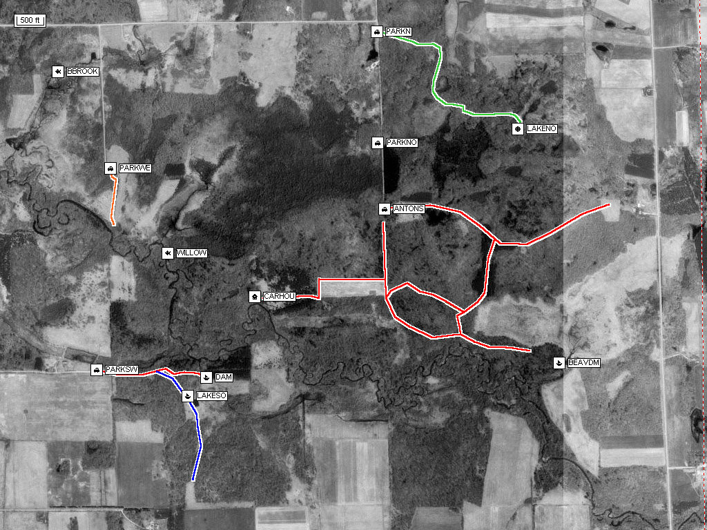
Aerial View
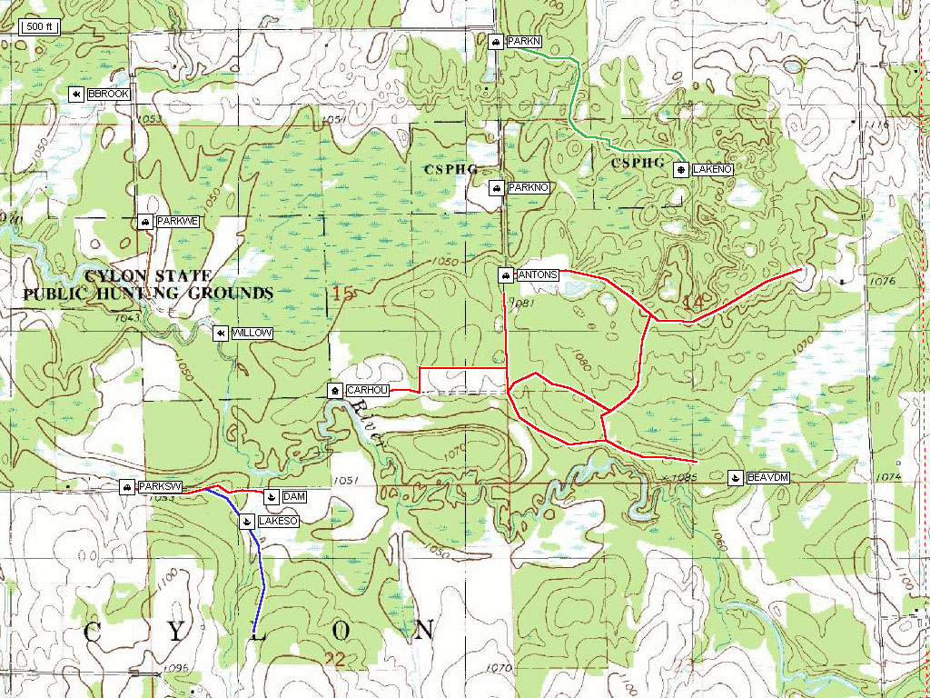
Topographical Map
East half aerial view, printer friendly.
West half aerial view, printer friendly.
East half topographical, printer friendly.
West half topographical, printer friendly.
Cylon Wildlife GPS Coordinates
Trail Map Page
Cylon Wildlife Area
Logging in the Cylon Wildlife Area 2001
and 2002
Home