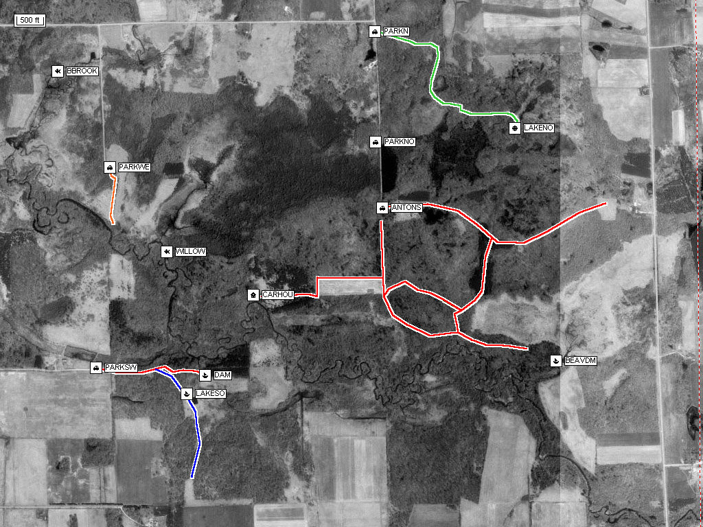
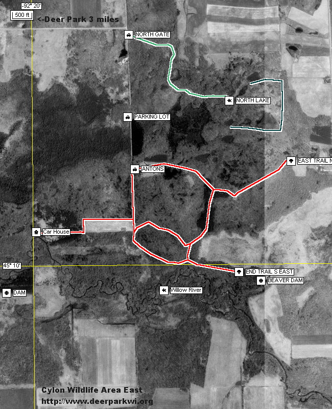
There are 6 maps available. The Cylon Aerial view is in black and white, with trails and local landmarks in the image.
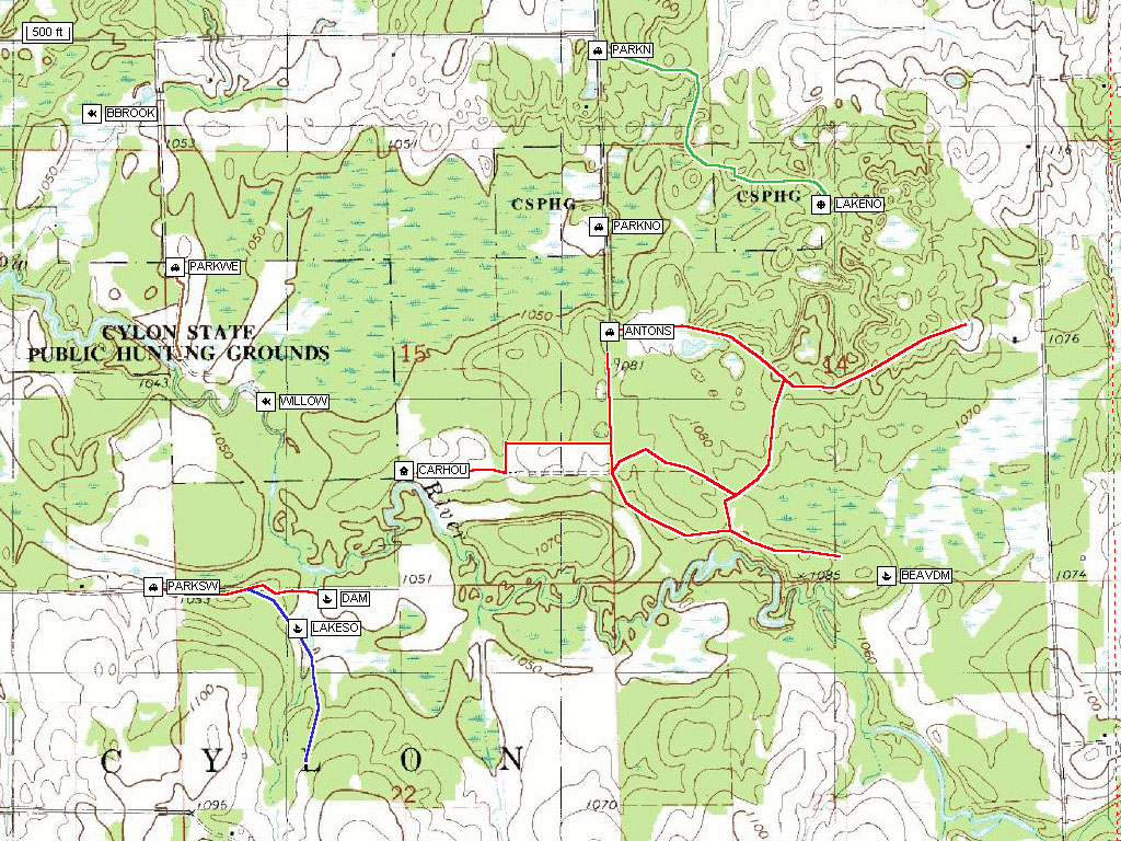
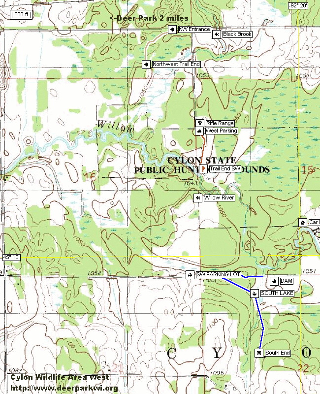
The Cylon Topographical color map has the same local information and trails on the map.
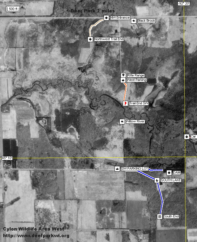
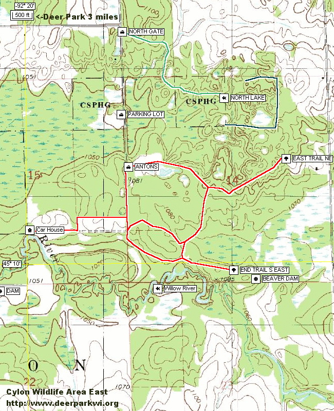
Trails were mapped out in the fall of 2000, 2001 and the spring of 2002. These maps are in the public domain and can be used as desired. Trail conditions change rapidly and there is no guarantee that they will be easily passable.
To get back to this page after viewing the photos use your "<-Back" button.